Carrai and Coachwood trails
North Coast, Country NSW
Overview
Carrai and Coachwood trails combines 2 remote 4WD adventures in Carrai National Park and Oxley Wild Rivers National Park, between Kempsey and Armidale.
- Where
- Carrai National Park, Werrikimbe National Park, Willi Willi National Park, The Castles Nature Reserve, Oxley Wild Rivers National Park in North Coast, Country NSW
- Distance
- 137km one-way
- Time suggested
- 2 days
- What to
bring - Drinking water, snacks, clothes for all weather conditions, first aid kit, personal locator beacon
- Please note
- This route combines Carrai trail in Carrai National Park and Coachwood trail in neighbouring Oxley Wild Rivers National Park.
- It can be driven in either direction.
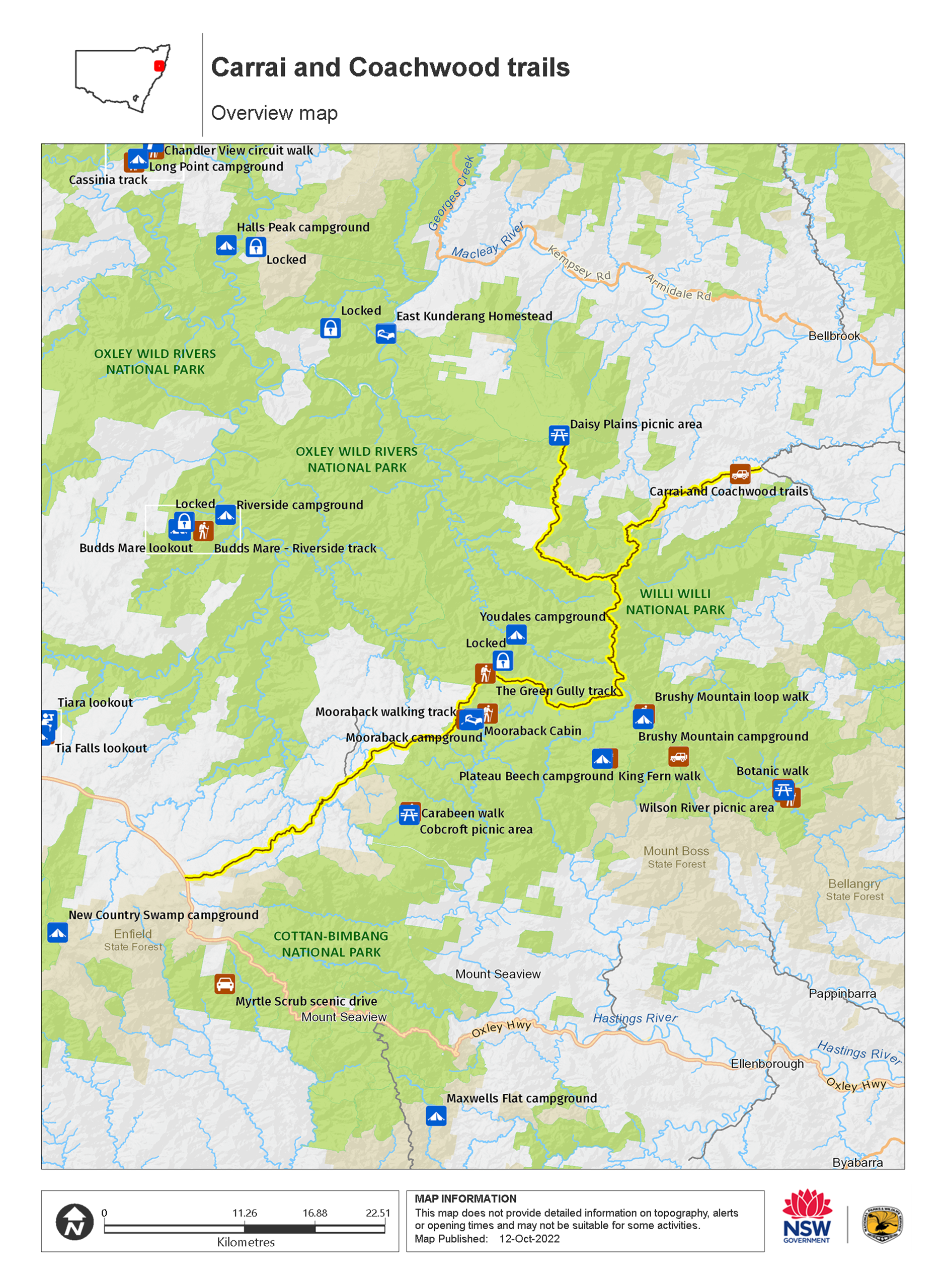
- The start of Carrai Road to Kookaburra is 24km. It’s another 22.5km to/from Daisy Plains picnic area. It’s around 51km from Coachwood Road to Oxley Highway via Racecourse trail and Kangaroo Flat Road.
- This is a remote area. Please ensure you’re well-equipped, with fuel, spare tyre, water, and warm clothing. It’s a good idea to bring a personal locator beacon.
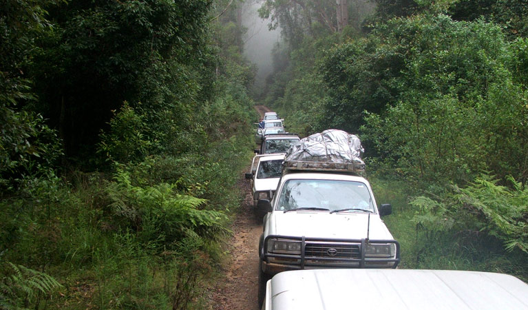
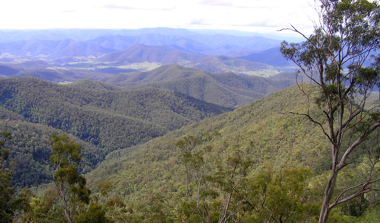
This route combines Carrai trail in Carrai National Park and Coachwood trail in Oxley Wild Rivers National Park. Driven in either direction, it’s a great way for self-reliant 4WD enthusiasts to explore the views and natural beauty of the mountain plateau west of Port Macquarie.
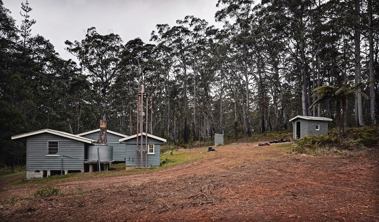
From Kempsey, it’s around a 1hr drive to reach Carrai trail, which follows unsealed Carrai Road through open farmland before delivering you into the forest. After around 24km, at the junction with Coachwood Road, stop for a break in Kookaburra. Once a thriving centre for trade in prized red cedar, it’s now a ghost town overgrown by trees.
From Kookaburra, continue around 22.5km north along Carrai trail, through old growth forest to Daisy Plains picnic area. Set among tall eucalypts, it's a good place to stop for lunch if you want a break from driving.
Listen to the squawk of glossy black cockatoos before backtracking to the junction with Coachwood Road. Follow this trail, which winds 17km through Gondwana rainforest in Oxley Wild Rivers National Park. The 300m walk to unfenced Hoppy’s lookout is an optional stop along the trail.
From the end of Coachwood trail, connect with scenic Racecourse trail around 19km, and make your way out via Werrikimbe National Park, and Walcha.
Map
Map legend
Local alerts
For the latest updates on fires, closures and other alerts in this area, see https://uat.nswparks.cloud/things-to-do/4wd-touring-routes/carrai-and-coachwood-trails/local-alerts
Park info
- in Carrai National Park in the North Coast and Country NSW regions
Carrai National Park is always open but may have to close at times due to poor weather or fire danger.
- in Oxley Wild Rivers National Park in the North Coast and Country NSW regions
Oxley Wild Rivers National Park is always open but may have to close at times due to poor weather or fire danger.
-
There are 3 areas in Oxley Wild Rivers National Park where you'll need day use vehicle permits: Halls Peak campground and picnic area, Riverside campground and picnic area, and Youdales Hut campground and picnic area. Day use vehicle permits can be bought online or by calling the National Parks Contact Centre on 1300 072 757. If camping, permit fees are included in the campground fee.
Contact us for permits.
- in Willi Willi National Park in the North Coast and Country NSW regions
Willi Willi National Park is always open but may have to close at times due to poor weather or fire danger.
- in Werrikimbe National Park in the North Coast and Country NSW regions
Werrikimbe National Park is always open but may have to close at times due to poor weather or fire danger.
- in The Castles Nature Reserve in the North Coast and Country NSW regions
Visitor info
All the practical information you need to know about Carrai and Coachwood trails.
Maps and downloads
Learn more
Carrai and Coachwood trails is in Carrai National Park. Here are just some of the reasons why this park is special:
A safe haven for native animals
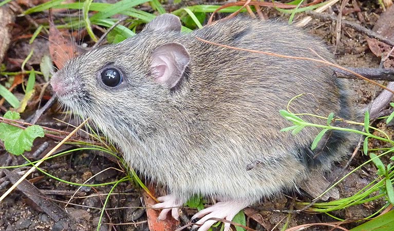
Maintaining vast tracts of remote forest, like those at Carrai, is essential for protecting biodiversity and keeping the populations of native animals at high levels. Carrai is known to harbour endangered species like the Hastings River mouse, a rodent that likes damp habitats, and the giant barred frog, which grows to a size of about 12cm and lays its eggs on banks overhanging rivers. Listen for its deep grunt when you stop by a creek.
- Daisy Plains picnic area Visit Daisy Plains picnic area when you travel through Carrai National Park by 4WD. It’s the perfect spot for peaceful lunch when exploring this park’s beautiful forests and steep escarpments.
From the 1800s
In many ways, Carrai’s remote location has protected it from extensive grazing and mining. In 1818, John Oxley was the first European to visit the New England Tablelands, closely followed by cedar loggers. Graziers eventually moved their stock up river valleys onto the tablelands. Both tin and gold were mined in the area until the 1960s, and forestry ceased in the early 90s.
- Carrai and Coachwood trails Carrai and Coachwood trails combines 2 remote 4WD adventures in Carrai National Park and Oxley Wild Rivers National Park, between Kempsey and Armidale.
Protecting Carrai's wilderness
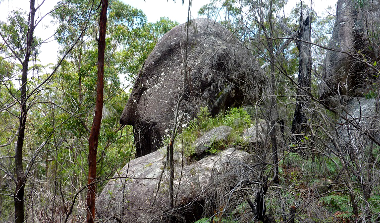
An area of 3,530ha within Carrai National Park has been declared wilderness under the Wilderness Act 1987. Although much of Carrai's forested area has been affected in some way by human habitation - logging and grazing, for example - it's now protected, allowing it to recover. There are three old-growth forest ecosystems in the park, including groves of white mahogany, dry redgum, bloodwood, native apple, and tallowwood. Look for the endangered Guthrie's grevillea, with its green and maroon flowers, as well as epiphytic orchids attached to the trunks of trees.
- Daisy Plains picnic area Visit Daisy Plains picnic area when you travel through Carrai National Park by 4WD. It’s the perfect spot for peaceful lunch when exploring this park’s beautiful forests and steep escarpments.
Traditional lands of Thunggutti People
The Carrai plateau is a special place for the Thunggutti People, with many ceremonial sites that have their origins in the dreamtime. It's believed that Aboriginal people moved from the coastal hinterlands to the New England Tablelands, including parts of what is now Carrai National Park, during the summer months. In the early to mid-1800s, the rugged country at the head of Macleay River also provided refuge for many Aboriginal people.
Plants and animals protected in this park
Animals
-

Rufous scrub-bird (Atrichornis rufescens)
The vulnerable rufous scrub-bird is a small, ground-foraging bird that lives only in isolated rainforest areas of south-eastern Australia.
-

Swamp wallaby (Wallabia bicolor)
The swamp wallaby, also known as the black wallaby or black pademelon, lives in the dense understorey of rainforests, woodlands and dry sclerophyll forest along eastern Australia. This unique Australian macropod has a dark black-grey coat with a distinctive light-coloured cheek stripe.
-

Southern boobook (Ninox novaeseelandiae)
The southern boobook, also known as the mopoke, is the smallest and most common native owl in Australia. With a musical 'boo-book' call that echoes through forests and woodlands, the southern boobook is a great one to look out for while bird watching.
-

Common brushtail possum (Trichosurus vulpecula)
One of the most widespread of Australian tree-dwelling marsupials, the common brushtail possum is found across most of NSW in woodlands, rainforests and urban areas. With strong claws, a prehensile tail and opposable digits, these native Australian animals are well-adapted for life amongst the trees.
Education resources (1)
Operated by
- Walcha office
- Monday to Friday, 8.30am to 4.30pm.
- 02 6777 4700
- npws.nea@environment.nsw.gov.au
- 188W North Street, Walcha NSW 2354