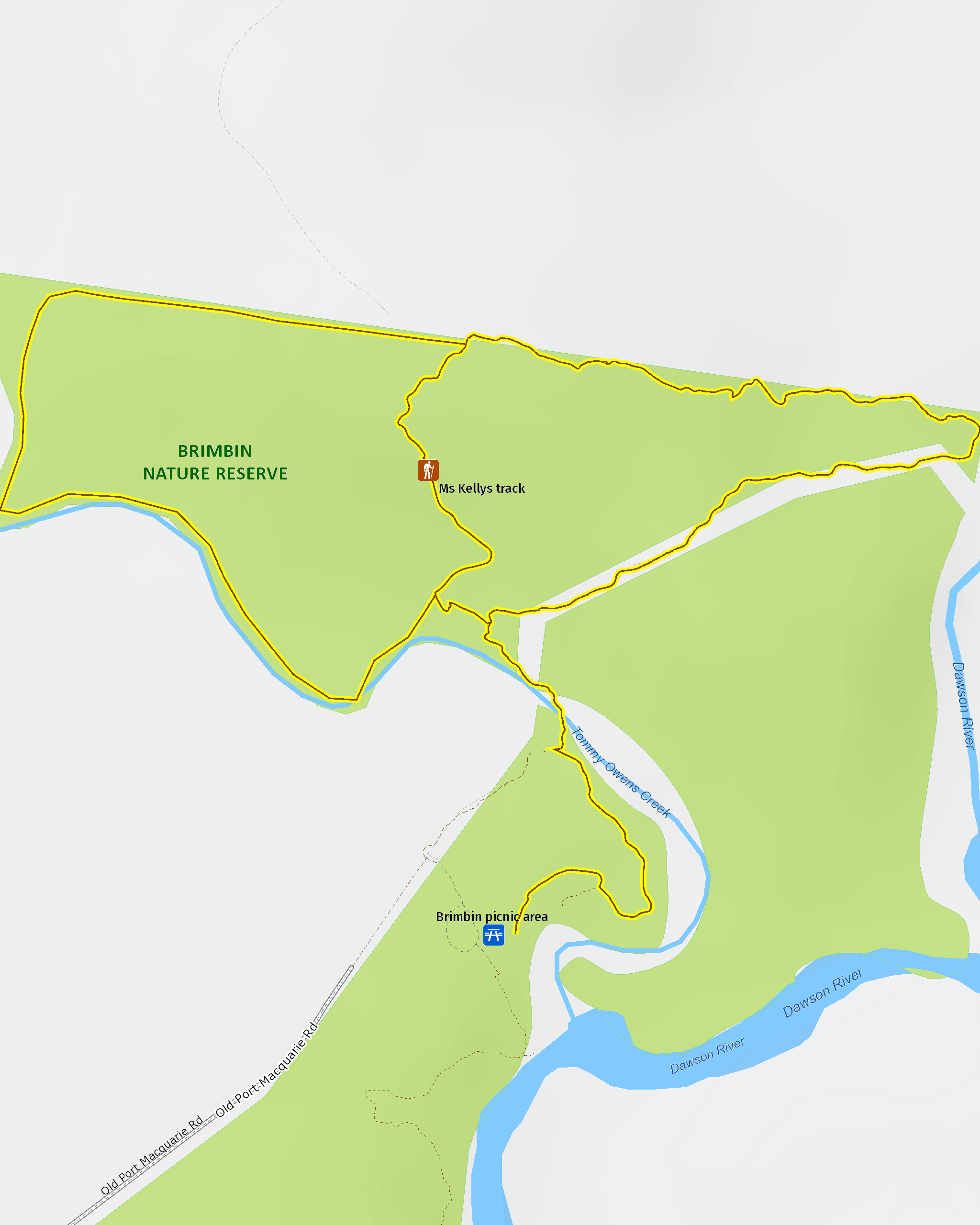
Ms Kellys walking track
Brimbin Nature Reserve
Overview
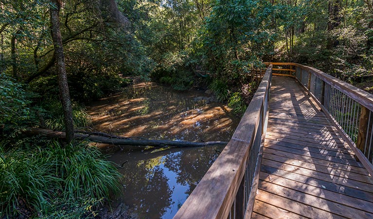
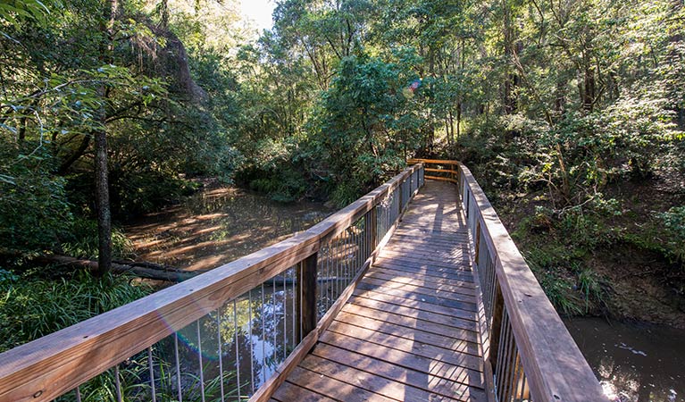
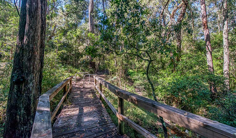
Ms Kellys walking track in Brimbin Nature Reserve is a short walking track near Taree, that follows a historic bullock route and takes in landmarks with names significant to the area’s historic heritage.
- Where
- Brimbin Nature Reserve in North Coast
- Accessibility
- Hard
- Distance
- 1.5km loop
- Time suggested
- 45min - 1hr 15min
- Grade
- Grade 3
- What to
bring - Hat, sunscreen, drinking water
- Please note
- The weather in the area can be extreme and unpredictable, so please ensure you’re well-prepared for your visit.
- Remember to take your binoculars if you want to birdwatch.
Isabella Mary Kelly, New South Wales’ only independent female colonial settler, was a wealthy Irish woman who sailed into Sydney Harbour in 1834 looking for a tree change. She bought up Crown Land and ran her own station. Isabella was apparently disliked by her neighbours for doing ‘men’s work’, her house burnt down in her absence and she was, for a time, unjustly imprisoned after subletting to a conman. History has painted her character in various extremes, from a gun-slinging tyrant to a brave pioneering hero.
Beginning at Tommy Owens Crossing, the track passes through a dense area of swamp oak then, from Ms Kellys Crossing, follows part of Old Port Macquarie Road. From the late 1820s, this historic route allowed bullock-drawn vehicles to cross Dawson River and continue on to Port Macquarie.
It’s a great trail for walking with children. See how many different birds they can spot along the way.
Map
Map legend
Local alerts
For the latest updates on fires, closures and other alerts in this area, see https://uat.nswparks.cloud/things-to-do/walking-tracks/ms-kellys-walking-track/local-alerts
General enquiries
- National Parks Contact Centre
- 7am to 7pm daily
- 1300 072 757 (13000 PARKS) for the cost of a local call within Australia excluding mobiles
- parks.info@environment.nsw.gov.au
Park info
- in Brimbin Nature Reserve in the North Coast region
Brimbin Nature Reserve is always open but may have to close at times due to flood events, poor weather or fire danger.
Visitor info
All the practical information you need to know about Ms Kellys walking track.
Maps and downloads
Learn more
Ms Kellys walking track is in Brimbin Nature Reserve. Here are just some of the reasons why this park is special:
Biripi Aboriginal Nation
When Europeans settled in Manning Valley, the area was occupied by Aboriginal people: the Biripi Nation. This Aboriginal nation is made up of small groups of mostly one or two families, who travelled their country as availability to food sources changed with the seasons. The Biripi harvested native plants, each for a specific use. Identify their food plants, medicinal plants, arts/crafts plants and cultural plants when you visit Brimbin with the help of the Biripi Nation website.
Feathering the nest
Manning Valley has over 260 different species of bird, many of which inhabit Brimbin, making it an ideal spot for bird watching. Nests can be seen along waterways. Due to the range of plant communities within the reserve and its proximity to the coast, waterbirds, raptors, woodland and seabirds can be seen at Brimbin. This includes the largest owl on the Australian continent: the powerful owl.
Shady grove

The name 'Brimbin' comes from a local Aboriginal word for 'stringybark', which are common to the reserve, as are white mahogany, tallowwood and turpentine. Narrow-leaved red gums provide important food and habitat for koalas. Grey myrtle, swamp oak and water gum can be found along the waterways, with mangroves lining the banks below the tidal limit. River mangrove is usually a bushy shrub, with elongated fruit and clustered white flowers that smell like banana. Its main identifying feature is salt encrustation on its spoon-shaped leaves. Grey mangroves grow, in this area, to around 10m, and have oval pointed leaves, pale green flattened fruit and spongy pencil-like aerial roots spreading from the base of the trunk.
- Brimbin picnic area Not far from Taree, Brimbin picnic area’s idyllic riverside location is a great spot for picnicking, barbecues, canoeing and birdwatching. It’s also where Dawson River walking track begins in Brimbin Nature Reserve.
- Dawson River walking track Starting at the Brimbin picnic area near Taree, Dawson River walking track follow the mangrove-lined waterway of Brimbin Nature Reserve, and joins with a historic bullock route.
The Long Paddock
The Travelling Stock Route (TSR) in Australia is an authorised thoroughfare for walking domestic lifestock between locations, and these routes are collectively known as 'The Long Paddock'. Parts of Brimbin were originally the TSR of a stock camp sold in the 1960s. Old Port Macquarie Road, now part of Ms Kellys walking track, follows a section of track established in the 1820s linking Port Macquarie to the Australian Agricultural Co. lands at Stroud and Gloucester. The route allowed bullock-drawn carts to cross Dawson River.
- Dawson River walking track Starting at the Brimbin picnic area near Taree, Dawson River walking track follow the mangrove-lined waterway of Brimbin Nature Reserve, and joins with a historic bullock route.
- Ms Kellys walking track Ms Kellys walking track in Brimbin Nature Reserve is a short walking track near Taree, that follows a historic bullock route and takes in landmarks with names significant to the area’s historic heritage.