Pieries Peak walking track
Mount Royal National Park
Overview
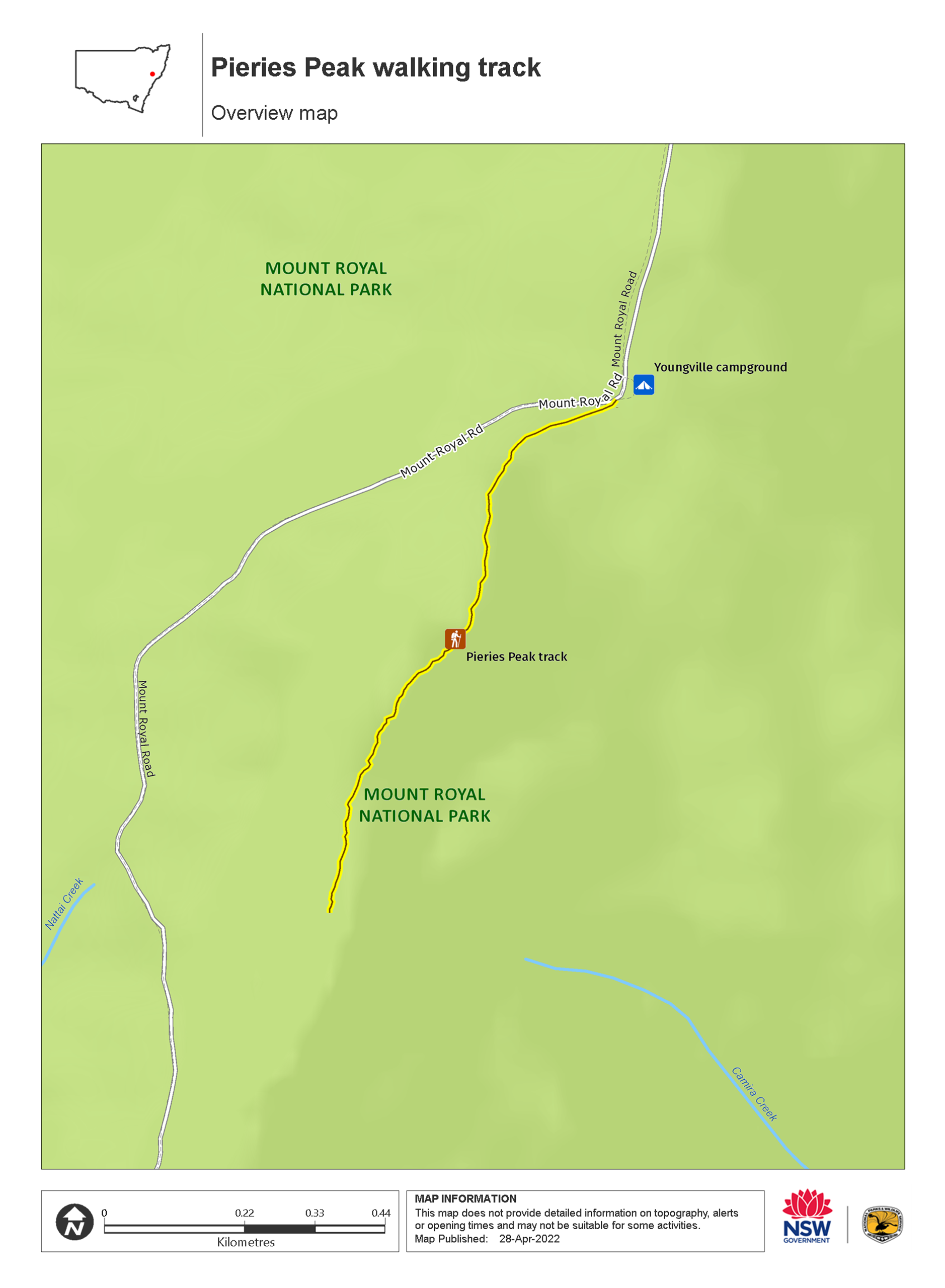
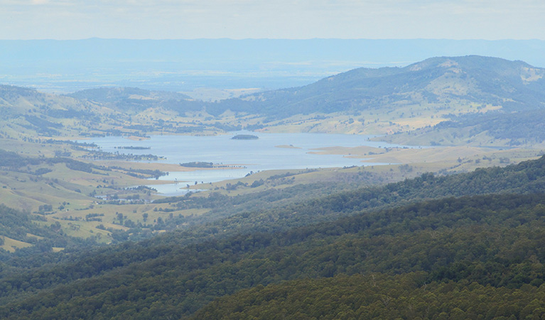
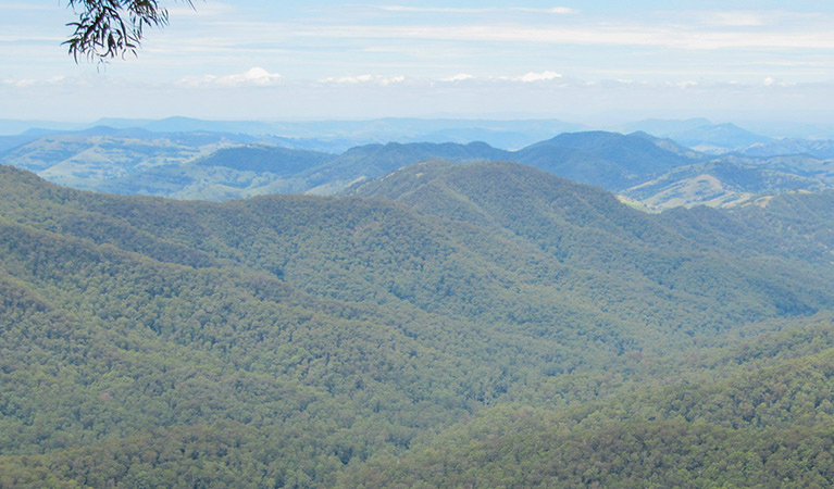
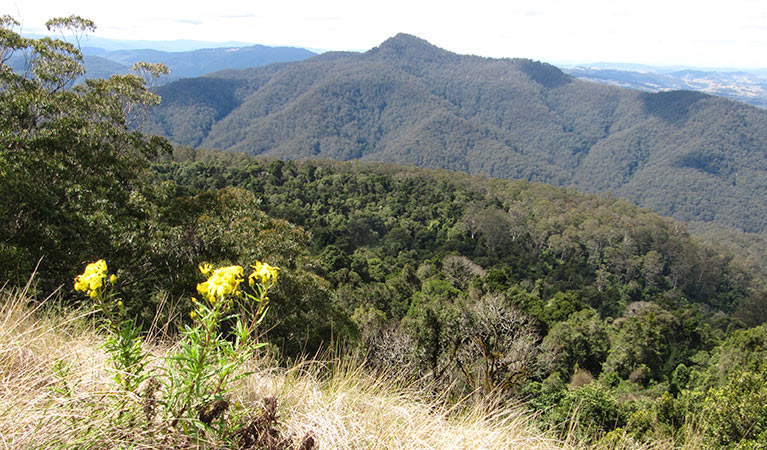
Pieries Peak walking track allows visitors to hike from Youngville campground to a scenic lookout across the Hunter Valley and Lake Saint Clair.
- Where
- Mount Royal National Park in North Coast, Country NSW
- Distance
- 3km return
- Time suggested
- 1hr 30min - 2hrs 30min
- Grade
- Grade 4
- Trip Intention Form
-
It's a good idea to let someone know where you're going. Fill in a trip intention form to send important details about your trip to your emergency contact.
- What to
bring - Drinking water, hat, sunscreen
- Please note
- The weather in this area can be extreme and unpredictable, so please ensure you’re well-prepared for your visit.
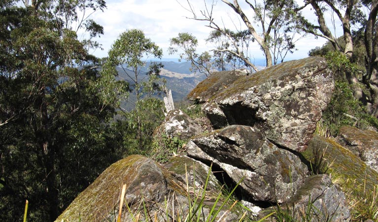
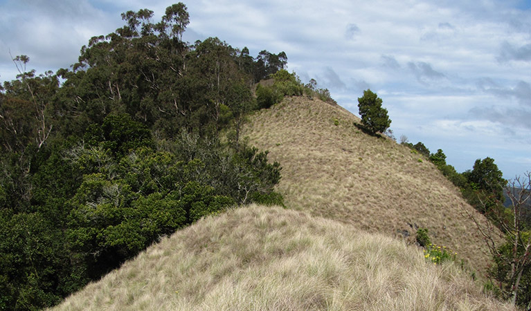
Pieries Peak walking track is a short climb from Youngville campground to the peak. The track follows a narrow and rocky ridge with steep sides. It’s not for the faint hearted. Make sure you take some treats to celebrate when you reach the peak. Pause to enjoy the scenic views across the Hunter Valley.
Keep an eye out for wedge-tailed eagles soaring above. See if you can spot seasonal visitors like dollar birds and channel-billed cuckoos. You could also encounter brush turkeys, superb lyrebirds, honeyeaters and flycatchers around the track.
Rug up in winter. When the westerly winds blow, the peak can be extremely cold.
Map
Map legend
Local alerts
For the latest updates on fires, closures and other alerts in this area, see https://uat.nswparks.cloud/things-to-do/walking-tracks/pieries-peak-walking-track/local-alerts
General enquiries
- National Parks Contact Centre
- 7am to 7pm daily
- 1300 072 757 (13000 PARKS) for the cost of a local call within Australia excluding mobiles
- parks.info@environment.nsw.gov.au
Park info
- in Mount Royal National Park in the North Coast and Country NSW regions
Mount Royal National Park is always open but may have to close at times due to poor weather or fire danger.
Visitor info
All the practical information you need to know about Pieries Peak walking track.
Maps and downloads
Learn more
Pieries Peak walking track is in Mount Royal National Park. Here are just some of the reasons why this park is special:
An important cultural place
The area now covered by Mount Royal National Park, Barrington Tops National Park and Barrington Tops State Conservation Area is the traditional land of the Biripi, Worimi, Geawegal, Wonaruah and Ungooroo People. Although these people were dispossessed of their land after European settlement of New South Wales, they continue to have a deep attachment to the country and an active interest in its management. This place contains important foods, medicinal plants, animal species and sacred sites.
Safe haven
The rich diversity of vegetation offers habitat for a wide range of birds and animals, many of which are rare and threatened. These include: the endangered hastings river mouse; the threatened parma wallaby (described by British naturalist John Gould way back in 1840 as 'shy' and 'cryptic'; and the vulnerable spotted-tailed quoll, which is the largest marsupial carnivore on mainland Australia. The old growth forest is also habitat for four large forest owls - masked, barking, powerful and sooty - all of which are threatened species. Mount Royal National Park has a variety of forest types and vegetation communities, ranging from shrubland to tall open forest and wet eucalypt forest. The most dominant form of vegetation is mid-altitude grassy forest with plentiful stands of New England blackbutt, Sydney blue gum and grey gum.
- Carrow Brook walking track Carrow Brook walking track is a remote walk into the valleys of Mount Royal National Park, near Singleton. A challenging loop hike, it’s best suited to fit, experienced bushwalkers.
Same as always
Mount Royal National Park is listed as part of the Gondwana Rainforests of Australia. Formerly known as the Central Eastern Rainforest Reserves, these include the most extensive areas of subtropical rainforest in the world, large areas of warm temperate rainforests and nearly all of the Antarctic beech cool temperate rainforest. Few places on earth contain so many plants and animals that remain relatively unchanged from their ancestors in fossil records.
The changing face
After government surveyors explored this area in the very early 1800s, the land soon became mined for gold, logged for its timber and used to graze lifestock. Small settlements established themselves on the plateau, mainly due to these agricultural opportunities. From the early 1900s, however, the area became increasingly popular for recreation and for scientific expeditions.