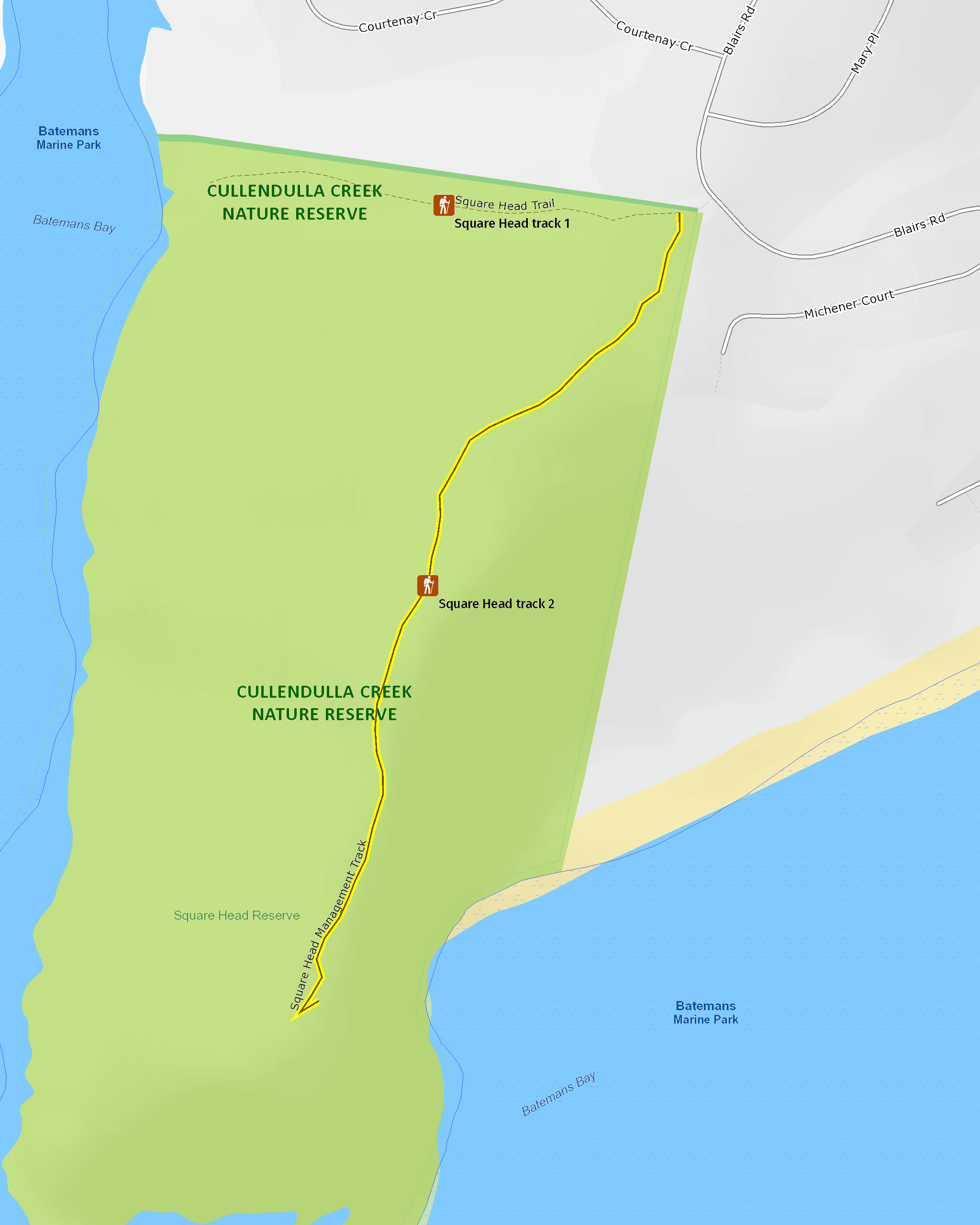
Square Head track 2
Cullendulla Creek Nature Reserve
Overview
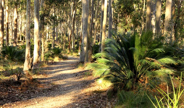
This short walk through burrawangs and spotted gums, populated with birds, offers one of the best scenic views in the whole reserve and a hidden fishing spot.
- Accessibility
- Medium
- Distance
- 1.8km return
- Time suggested
- 30 - 45min
- Grade
- Grade 3
- What to
bring - Hat, sunscreen, drinking water
- Please note
- Shore birds are best seen on low tide. It’s a good idea to check the tides charts beforehand. Remember to take your binoculars if you want to bird watch
Looking for a great place to survey Batemans Bay and the nearby islands? This charming walk through fragrant spotted gum forest follows a vehicle management trail, with plenty of honeyeaters, little lorikeets, and echidnas foraging around the burrawangs below.
After a short hike, you reach the scenic Square Head, where generous views out to sea encompass Batemans Bay, Long Beach, Snapper Island, and the two Tollgate islands. Keep the camera handy – you might even spot a pair of endangered gang-gang cockatoos perched in the bush.
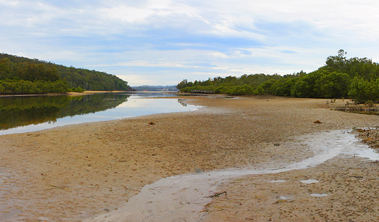
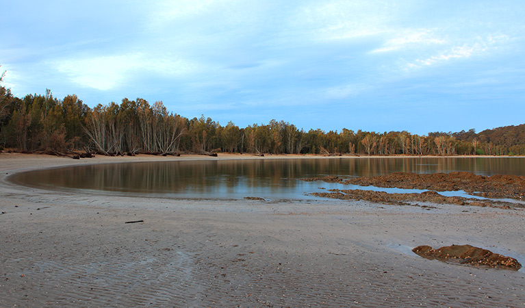
The nearby estuary beach offers a terrific picnic spot. If you enjoy fishing, an informal access track to the water below is popular with rock fishermen from the local area.
Map
Map legend
Local alerts
For the latest updates on fires, closures and other alerts in this area, see https://uat.nswparks.cloud/things-to-do/walking-tracks/square-head-track-2/local-alerts
General enquiries
- National Parks Contact Centre
- 7am to 7pm daily
- 1300 072 757 (13000 PARKS) for the cost of a local call within Australia excluding mobiles
- parks.info@environment.nsw.gov.au
Park info
- in Cullendulla Creek Nature Reserve in the South Coast region
Cullendulla Creek Nature Reserve is always open but may have to close at times due to poor weather or fire danger.
Visitor info
All the practical information you need to know about Square Head track 2.
Maps and downloads
Learn more
Square Head track 2 is in Cullendulla Creek Nature Reserve. Here are just some of the reasons why this park is special:
Aboriginal culture
Cullendulla Creek holds several ancient Aboriginal midden sites, including rarely recorded mounded midden sites. The Mangrove walk is a great way to engage with the past lives of people here, weaving through areas where mud oysters, mussels and shellfish were once collected.
Birdwatchers' haven
Cullendulla Creek Nature Reserve is home to mangrove estuary (and two mangrove species, the grey and river mangroves), forest red gums, littoral rainforest, and sea grass beds. The reserve is also a fish nursery for the Clyde River. Unsurprisingly then, a substantial mix of forest and shorebirds visit the area annually, including white ibises, curlews, two species of spoonbill and several of duck. Migratory birds come from as far away as Russia, taking refuge in the warm weather.
- Square Head track 1 This short walk offers rich rewards, leading to the entrance of Cullendulla Creek, perfect for an afternoon picnic and swim near the shorebirds.
- Tomaree Coastal Walk Explore a mountain summit, beaches, rock platforms, and Worimi Aboriginal culture on this multi-day adventure along Tomaree Coastal Walk.
Remarkable dune formations
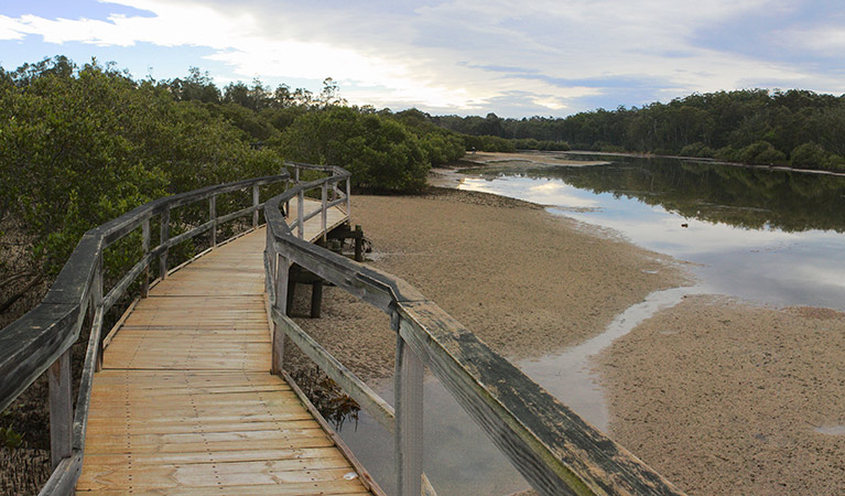
The nature reserve contains important and unusual dune formations called cheniers. Roughly parallel to the shoreline, these long, low (3-6m) and narrow ridges overlay estuarine mud and are of great scientific interest for the information they provide about the evolving landscape - some 7000 years worth of changes. There are nine beach ridges at Cullendulla; the most northerly two are cheniers. Though they're not directly visible to visitors, a fascinating boardwalk tracks through the mangrove estuary, accompanied by signs which offer a keen insight into the local ecosystem. For the best overview, visit in both high and low tide and compare the differences.
- Mangrove walk An easy walk offering great birdwatching opportunities, Mangrove walk is partly along an elevated boardwalk, giving an insight into the unusual dune formations.