Coolah Tops National Park
Overview
Coolah Tops National Park is a playground for walkers and mountain bikers looking for a great cycling and camping experience.
Read more about Coolah Tops National Park
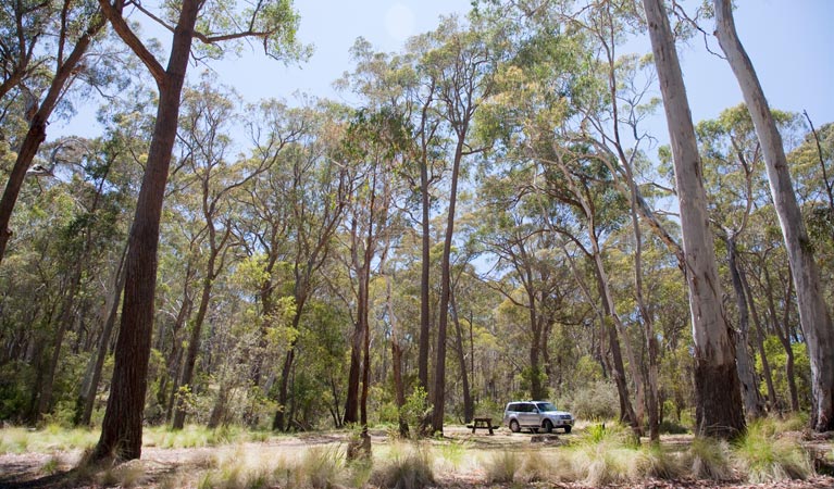
Sitting at the junction of the Warrumbungle and Liverpool ranges, Coolah Tops National Park is a beautiful landscape of giant grass trees, tall eucalypt forests and stands of huge snow gums. Take in spectacular views and see magnificent waterfalls on walking trails like The Falls link track, Racecourse track or Grasstrees track. Explore the Bundella track and Mullion track on your mountain bike. Birdwatchers should keep their eyes open, as Coolah Tops is home to an abundance of wildlife and birdlife, so you might see wallabies, eagles, gliders and rare owls.
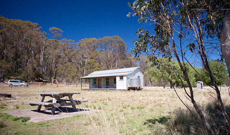
You may need to spend a weekend discovering everything that Coolah Tops has to offer. There’s remote camping, so you can spend the night stargazing, or after a day of walking and mountain biking, perhaps you’d prefer to sleep soundly at rustic Bracken’s Cottage.
Local alerts
For the latest updates on fires, closures and other alerts in this area, see https://uat.nswparks.cloud/visit-a-park/parks/coolah-tops-national-park/local-alerts
Contact
- in the Country NSW region
Coolah Tops National Park is always open but may have to close at times due to poor weather, fire danger or management operations. The eastern end of the park is regularly closed during wet weather due to slippery road conditions.
-
-
Warrumbungle NP Visitor Information Centre
02 6825 4364
Contact hours: 9am to 4pm daily. Closed Christmas Day. - 4261 John Renshaw Parkway, Warrumbungle NSW 2828
-
Email: warrumbungle.np@environment.nsw.gov.au
-
Warrumbungle NP Visitor Information Centre
Visitor info
All the practical information you need to know about Coolah Tops National Park.
Map
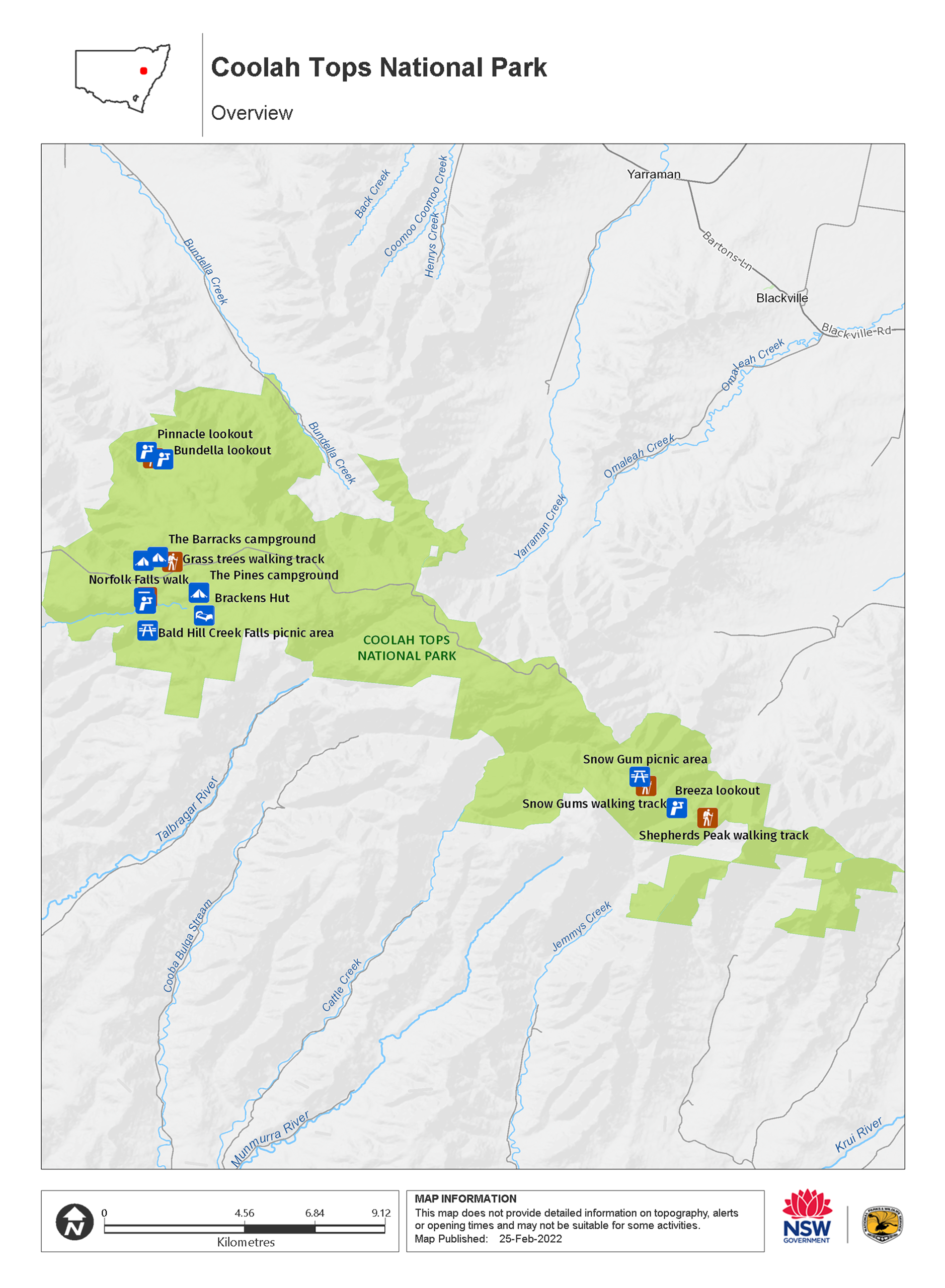
Map legend
Maps and downloads
Nearby towns
Coolah (31 km)
Coolah is the gateway to Coolah Tops National Park, a subalpine park with tall eucalypt forests, waterfalls, giant grass trees and scenic forest drives. See animals in the wild, including the greater glider - the largest of Australia's gliding possums.
Coonabarabran (112 km)
Coonabarabran is the closest town to the craggy peaks and spires of the Warrumbungle Ranges. Warrumbungle National Park is popular for bushwalking, camping and encountering wildlife amid breathtaking scenery.
Merriwa (114 km)
Merriwa is a unique and friendly rural town nestled in the Upper Hunter Valley. Situated on the Golden Highway, Merriwa is the ideal place for a stopover, as it is centrally located. In just two hours you can reach Mudgee, Dubbo, Newcastle and Tamworth.
Learn more
Coolah Tops National Park is a special place. Here are just some of the reasons why:
Wildlife haven
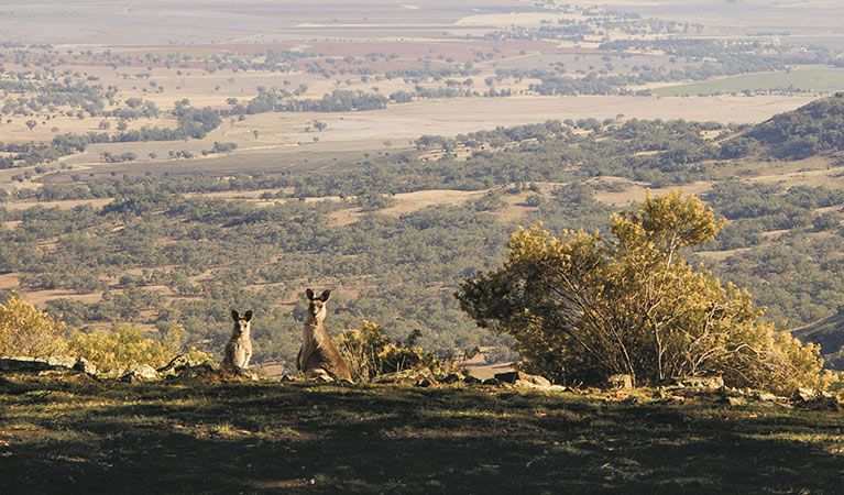
Looking out across the beautiful landscape of Coolah Tops National Park, it's obvious why you'll find so much wildlife here. Wander quietly along one of the walking tracks and you'll probably have a close encounter with red-necked wallabies and eastern grey kangaroos. You might also find a wombat waddling through the campground. Coolah Tops has some of the highest population densities of greater gliders in Australia. At night, keep your torch handy to see greater gliders, ring-tailed possums and possibly feather-tailed gliders or a sugar glider in the nearby trees.
- Grass Tree walking track Grass Tree walking track is a great way to explore a magical landscape of ancient grass trees in Coolah Tops National Park. A must-do for visitors, this easy walk starts at The Barracks campground.
- Shepherds Peak walking track For experienced bushwalkers, Shepherds Peak walking track in Coolah Tops National Park is a great way to explore sub-alpine forest. Come prepared for a steep scramble up the peak’s volcanic dome.
- Snow Gum walking track Snow Gum walking track in Coolah Tops National Park is an easy way to experience some of the largest known snow gum trees in a beautiful old-growth forest setting, near Coolah.
Get active in the bush
Pack your hiking boots and your mountain bike and be ready to get active in the bush at Coolah Tops. There are plenty of great walking tracks and trails to experience the bush on your bike. Make your way to lookouts like Shepherd's Peak or Breeza lookout for spectacular views to the north over the Liverpool Plains and the sheer escarpment. You'll also find several waterfalls along the escarpment where the creeks plunge over the plateau edge.
Education resources (1)
What we're doing
Coolah Tops National Park has management strategies in place to protect and conserve the values of this park. View the detailed park and fire management documents.
General enquiries
- National Parks Contact Centre
- 7am to 7pm daily
- 1300 072 757 (13000 PARKS) for the cost of a local call within Australia excluding mobiles
- parks.info@environment.nsw.gov.au
Contact
- in the Country NSW region
Coolah Tops National Park is always open but may have to close at times due to poor weather, fire danger or management operations. The eastern end of the park is regularly closed during wet weather due to slippery road conditions.
-
-
Warrumbungle NP Visitor Information Centre
02 6825 4364
Contact hours: 9am to 4pm daily. Closed Christmas Day. - 4261 John Renshaw Parkway, Warrumbungle NSW 2828
-
Email: warrumbungle.np@environment.nsw.gov.au
-
Warrumbungle NP Visitor Information Centre